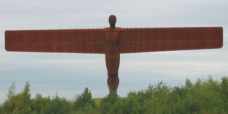
AngelOfTheNorth.jpg

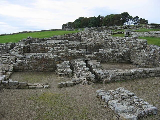
HousesteadsRomanFort.jpg
HousesteadsRuins1.jpg
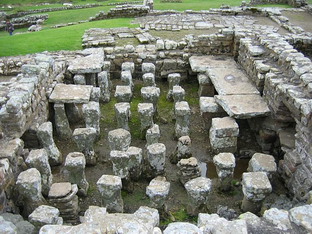
HousesteadsRuins2.jpg
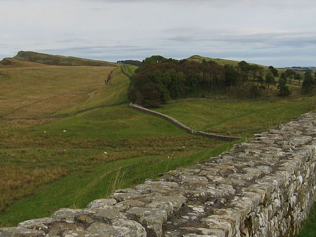
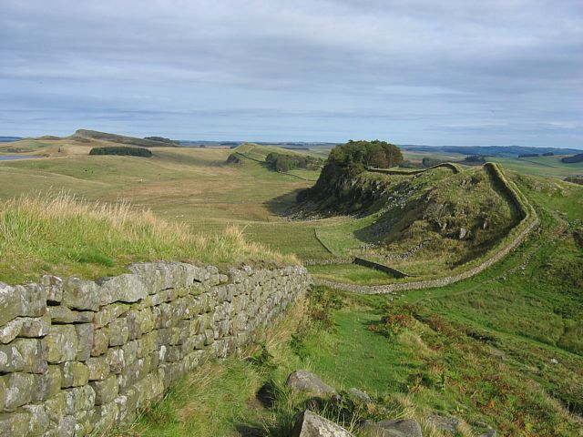
HadriansWall1.jpg

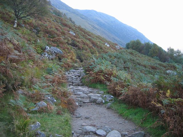
Milecastle37.jpg
Click here to return to the main Pictures index.
Click here to return to the main 2007 General Pictures Page.
Click here to go to Scotland 2007 Page 2.
Click here to go to the Aboyne 2007 page.
I made a holiday of it on the way to Aboyne. On the way I stopped at Carlisle, Fort William and Inverness. I stayed at Carlisle 1 night after exploring Hadrian's Wall and Housesteads Roman Fort. I then made a beeline for Glasgow and onto the A82 to get to Fort William for lunchtime. I had lunch at the top station on Aonach Mor after taking the gondola (cable car) up. I stayed at Fort William for 3 nights. In the intervening days I climbed to the summit of Ben Nevis and explored the road to the Isles, over to Skye on the ferry and back via the Skye Bridge. Then I transferred to Inverness via the Great Glen, Loch Ness and Glen Affric. The following day I had a blast driving to the north coast. I saw Dunnet Head, John O Groats, Duncansby Head and across the water, the Orkney isles. Then on the 6th it was a blast over a couple of passes and back down to Aboyne as early as possible to start the gliding itself.
Today I went via Newcastle and Hadrian's Wall to Carlisle.
|
AngelOfTheNorth.jpg |
HousesteadsRomanFort.jpg |
HousesteadsRuins1.jpg |
HousesteadsRuins2.jpg |
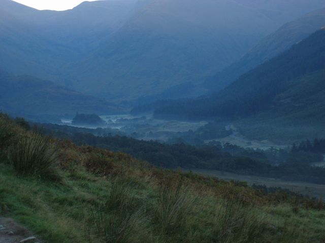
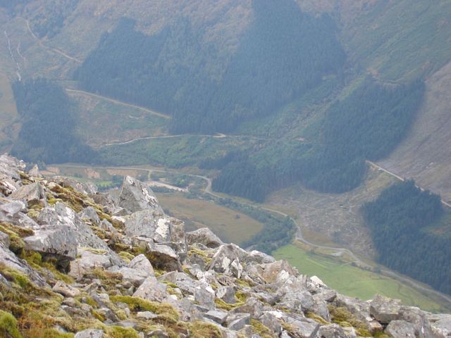
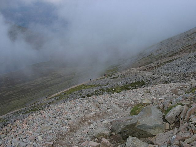
HadriansWall1.jpg |
Milecastle37.jpg |
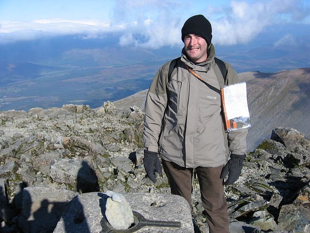
| Angel of the North as seen from a traffic jam on the A1. | Housesteads roman fort. | 2 sample shots of the fort. The commandant's house and under floor heating system. | Hadrian's Wall snaking away Eastwards from the fort. | Milecastle 37 (to the west of the fort). | |
 HadriansWall2.jpg |
 HadriansWall3.jpg |
| Looking back towards the fort from Milecastle 37. | Looking back to the fort from the Knag Burn gate (to the NE). |
I went from Carlisle to Fort William via Glasgow, and went on the Nevis Range Gondola to the Aonach Mor top station. Up there at over 2000 feet, with clear calm sunny skies, the views were excellent. Later on I went on a recce to Glen Nevis before returning to Fort William for the evening.
 PassingLochLomond.jpg |
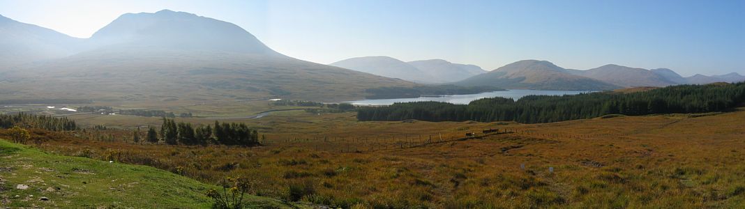 LochTulla.jpg |
 Bridge.jpg |
 CloudCap.jpg |
 RoadToFortWilliam.jpg |
 FortWilliamApproach.jpg |
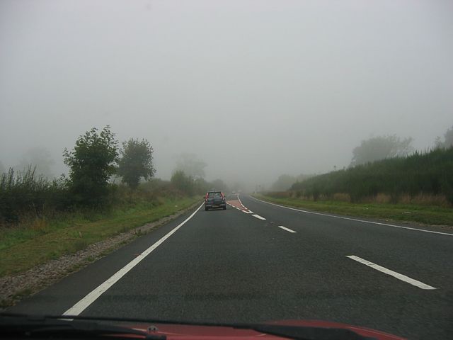
| Escaping Glasgow, passing a foggy Loch Lomond. | After climbing above the fog, 3 shot panorama taken from a viewpoint above Loch Tulla, and a zoom in of the bridge I just crossed. | Carrying on en route to Fort William as the mountains get bigger around me. | Approaching Fort William from the South. Loch Linnhe on the left. | ||
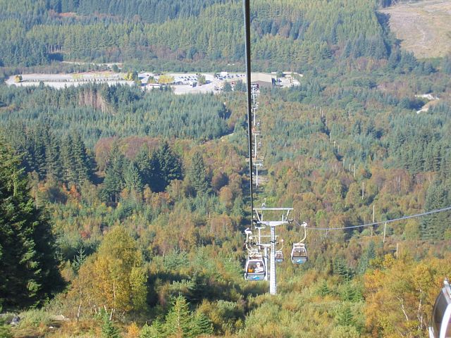 Gondola1.jpg |
 Gondola2.jpg |
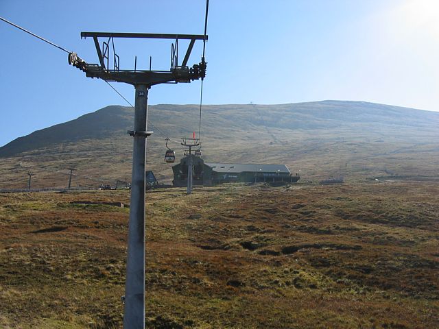
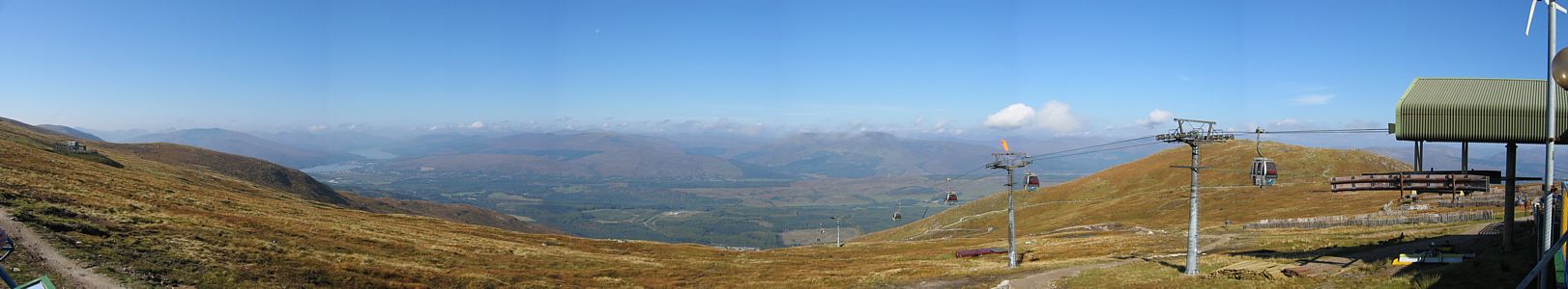 AonachMorTopStationPanorama.jpg |
 AonachMorTopStationView.jpg |
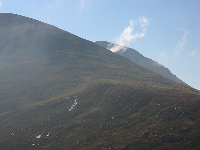 MeallBeagView1.jpg |
 MeallBeagView2.jpg |
| On the Nevis Range Gondola, looking down to the car park and base station, and approaching the top station. | Pictures taken from the top station on Aonach Mor: a 6 shot panorama and looking down towards Fort William. | 2 shots from the Meall Beag lookout point. Looking at Ben Nevis (behind the cloud) and looking to Fort William. | |||
 MeallBeagView3.jpg |
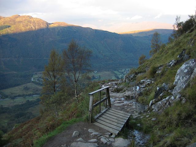
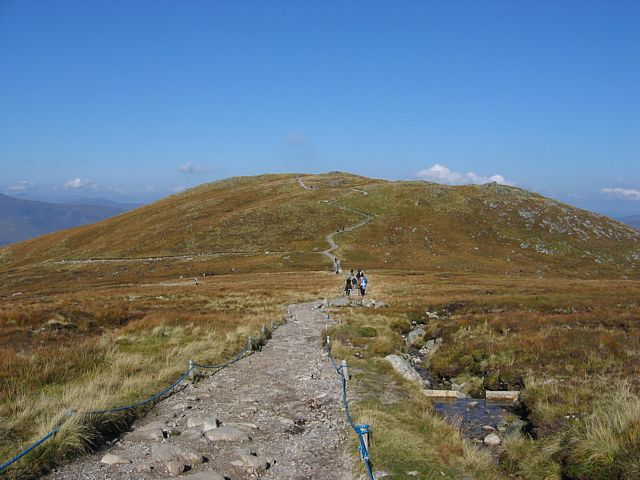 SgurrFinnisgAigPath1.jpg |
 SgurrFinnisgAigPath2.jpg |
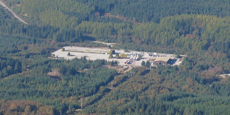
 LochLochy.jpg |
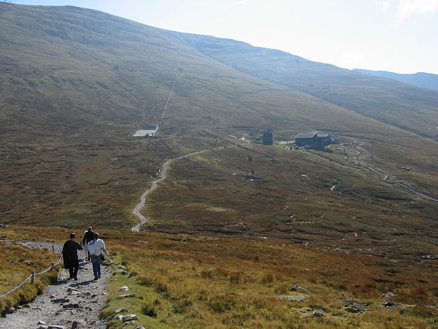
 BaseStation.jpg |
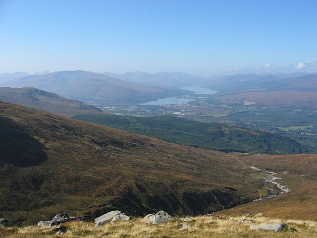
| Looking towards the summit of Aonach Mor from Meall Beag. | The path to the Sgurr Finnisg-aig lookout point. | Looking back to the top station. | Views from the lookout point. Loch Lochy and the great Glen, and the car park at the base of the mountain. | |
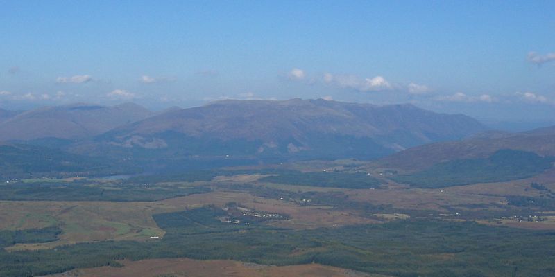
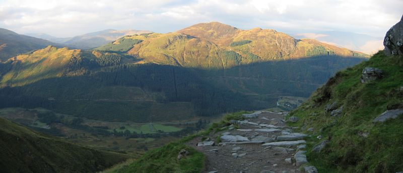
 SgurrFinnisgAigPanorama.jpg |
 GlenNevis1.jpg |
 GlenNevis2.jpg |
| A nearly 360 degree panorama taken from the Sgurr Finnisg-aig lookout point. You can see Fort William, Spean Bridge, Loch Lochy and the Great Glen, and Aonach Mor summit and top station. | Glen Nevis (and Achintee across the river) as seen from near the visitor centre. | |
 FortWilliam1.jpg |
 FortWilliam2.jpg |
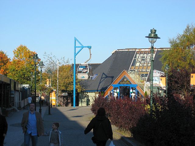 FortWilliam3.jpg |
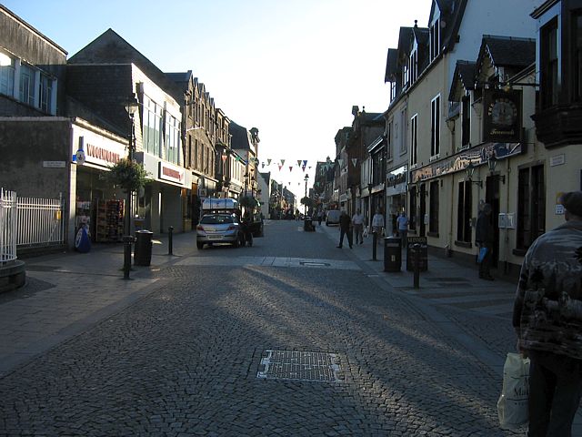 FortWilliam4.jpg |
 FortWilliam5.jpg |
 LochLinnhe.jpg |
| Pictures of Fort William as I walked along the high street in the centre. You can see how it nestles between Loch Linnhe and the mountains. | Looking along Loch Linnhe towards the Great Glen. | ||||
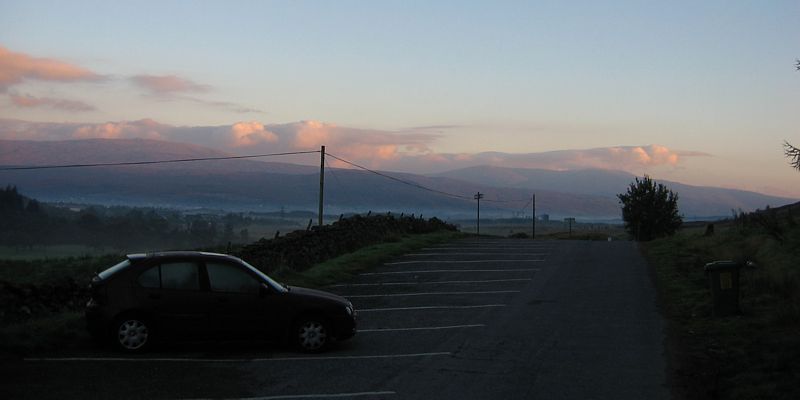
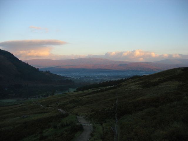
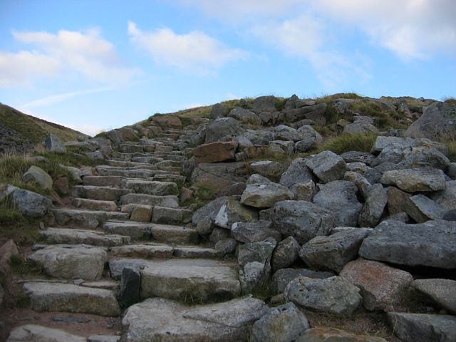
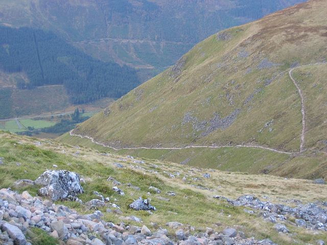
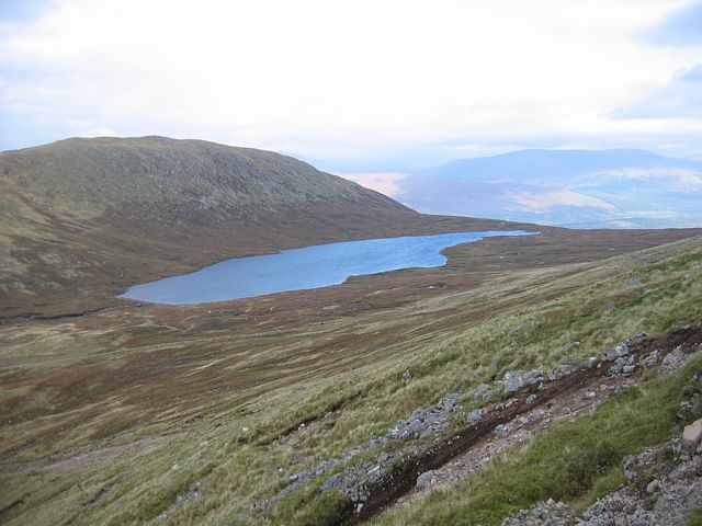
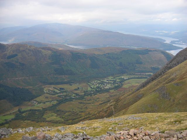
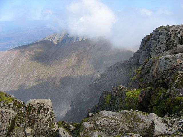
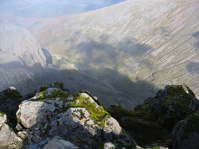
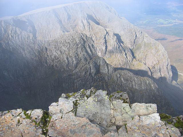
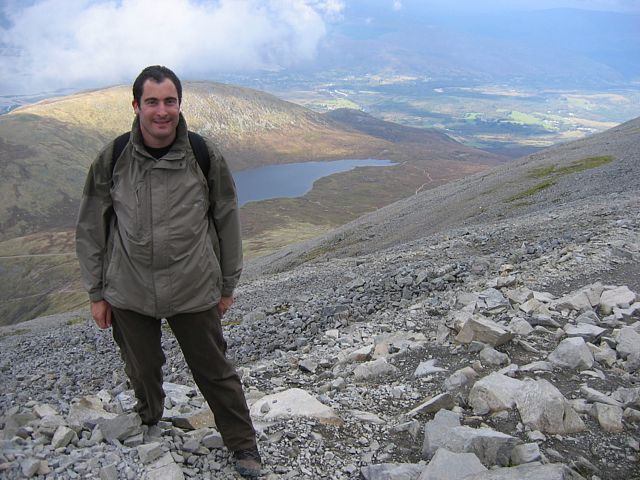
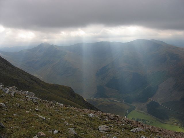
This was Ben Nevis day. I started early, and as the sun rose I was already on the path. The views as I ascended were outstanding. The bottom 1500 feet were the hardest. In the glen it was calm, and I overheated a little on the steep, tough and rocky path. Above the glen though a lovely cool breeze kicked in. As I passed Red Burn and the loch at 2000 feet I reached a plateau which made for a nice respite. Then on to Ben Nevis itself. From here to the top it was now loose rocks and a steep zig-zag track. But I was in my stride now, and made steady progress all the way to cloudbase at 3800 feet. Then on into the cloud, finally reaching the summit at 4400 feet. Up top it was only 4C and a fresh breeze, but no problem with all my layers, and hat / gloves on. After hanging around for a while a break in the clouds arrived and I got to see the Great Glen below to the north, as well as the more immediate 3000 foot sheer drop on that side. To the south I was peering above the clouds, with wisps pushing upslope to the summit and then above, around and through me across the summit plateau. After a few snacks I decided to descend once the cloud came in again. The descent was almost as hard as the ascent, and was a killer on the feet and knees having to control my descent carefully over the loose rocks, but I made it. This was one day to remember for a long time.
Thanks a lot to the kind hill walkers who kindly took my picture for me at the summit and on the way down.
 Achintee1.jpg |
 Achintee2.jpg |
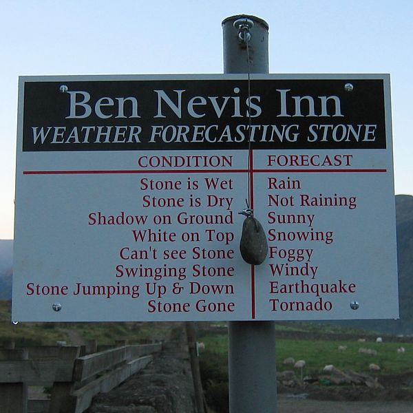 ForecastingStone.jpg |
 LowerTrail1.jpg |
 LowerTrail2.jpg |
 LowerTrail3.jpg |
 LowerTrail4.jpg |
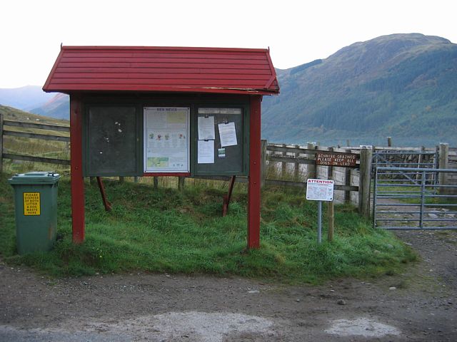
| Arriving at the start of the trail around sunrise. | Start of the trail. Weather forecasting Scottish style! | Walking along the lower trail as the sun rises above a misty and calm Glen Nevis. The higher I got the better the view behind me got. | ||||
 GlenNevisPanorama.jpg |
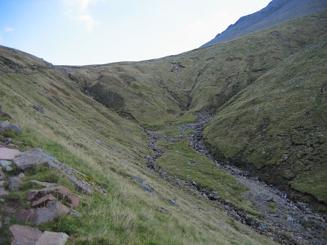 RedBurnTop.jpg |
 BenNevis.jpg |
 LowerTrail5.jpg |
 LowerTrailFromUpperTrail.jpg |
 LochanMeall1.jpg |
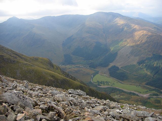
| Two shot panorama of Glen Nevis as I round the corner to climb past Red Burn to Lochan Meall. | The top end of Red Burn. Over that ridge is Lochan Meall and the plateau at 2000 feet. | Looking across Red Burn at Ben Nevis. You can just see the path ahead as it snakes up the mountain. | The last steep part before the plateau at 2000 feet. | Now on the upper trail. Looking down at the lower trail and the plateau that I just passed. | |
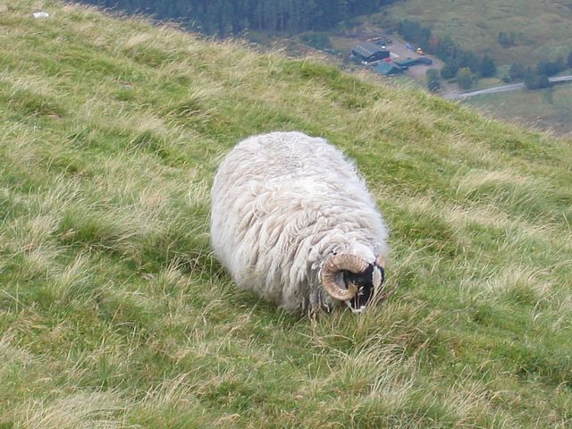 Sheep.jpg |
 GlenNevis1.jpg |
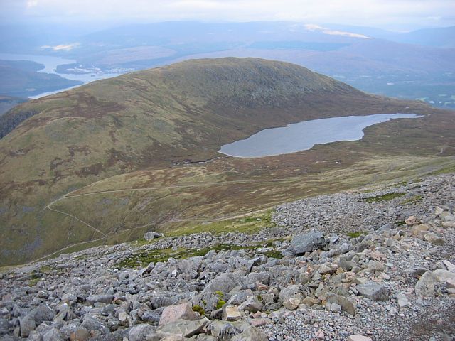 LochanMeall2.jpg |
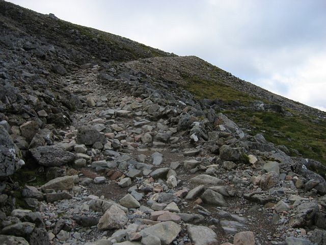 UpperTrail1.jpg |
 GlenNevis2.jpg |
 GlenNevis3.jpg |
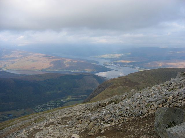
| Local resident. Wish I had that sort of view from my home or office. | Looking down at the plateau and Glen Nevis again as I carry on up the mountain. | Looking ahead it's pretty steep with lots of loose rocks now as I start to leave the grass behind. | Glen Nevis from 3000 feet. Lochs Linnhe and Eil beyond in the 2nd picture. | ||
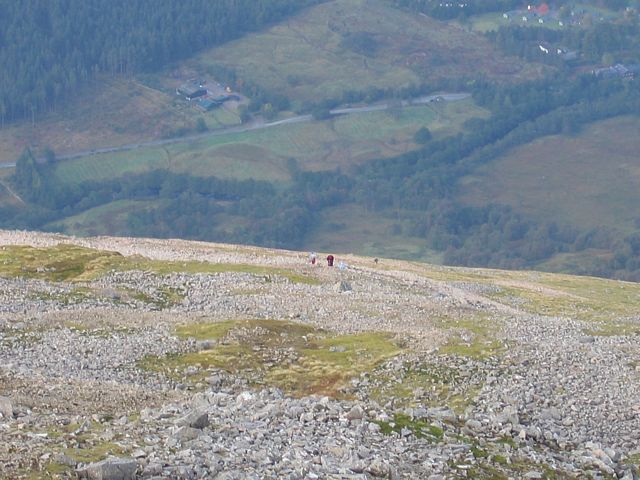 UpperTrail2.jpg |
 3700FootPanorama.jpg |
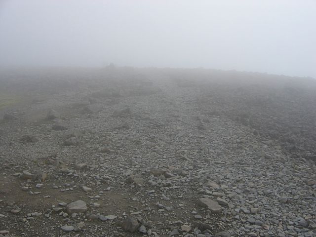 UpperTrail3.jpg |
 Cliff1.jpg |
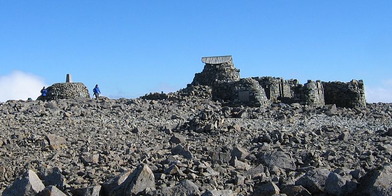
 Summit1.jpg |
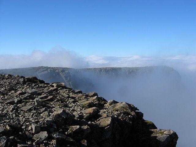
| People behind me on the trail. | Panorama of Glen Nevis, Fort William, Lochs Linnhe and Eil, and the plateau from 3700 feet, just below cloudbase. | Now at 4000 feet in cloud. | Finally made it to the summit plateau, albeit in cloud. Looking over the north face cliff all I can see is cloud. | The summit stone. |
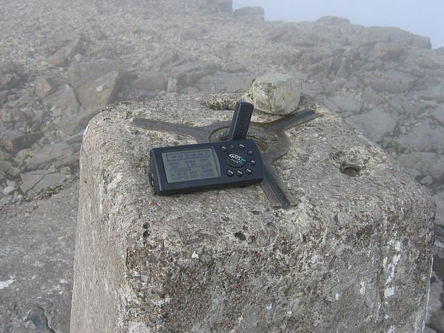 Summit2.jpg |
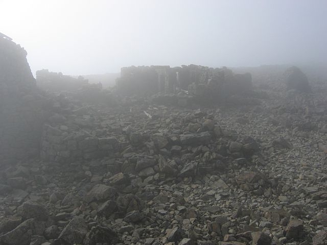 Summit3.jpg |
 Summit4.jpg |
 ViewSouth1.jpg |
 RockArt.jpg |
 ViewSouth2.jpg |
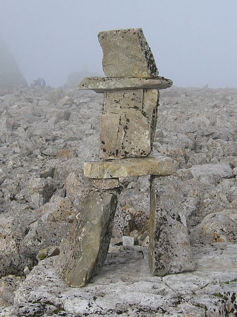
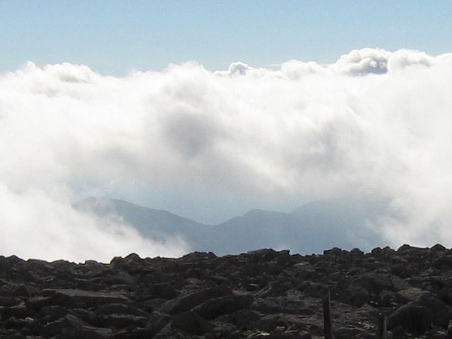
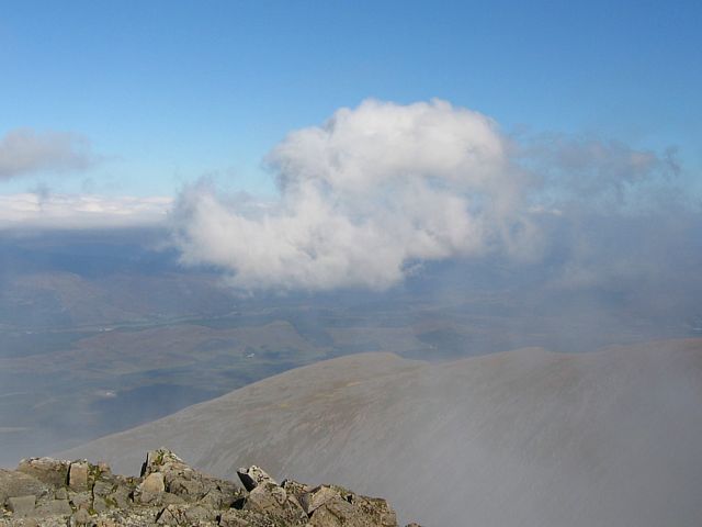
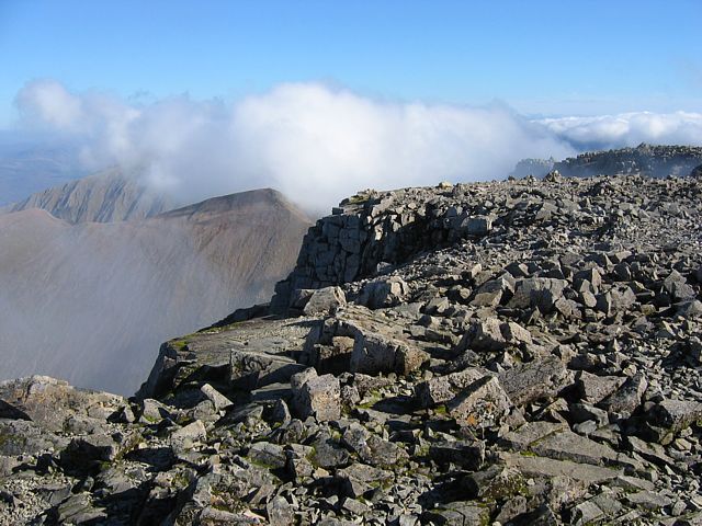
| My GPS sitting on the summit stone, reading 4460 feet. (I reckon it's out by 50 feet but never mind.) | Looking round at the ruins of the observatory and surrounding buildings, sticking out in a ghostly way from the cloud. | ...and suddenly there was a break in the clouds! | To the south it was fairly cloudy, but the view was heavenly. | Rock Art. | Peeking under the clouds to see more distant mountains below. |
 ViewWest1.jpg |
 ViewNE1.jpg |
 ViewEast1.jpg |
 ViewWest2.jpg |
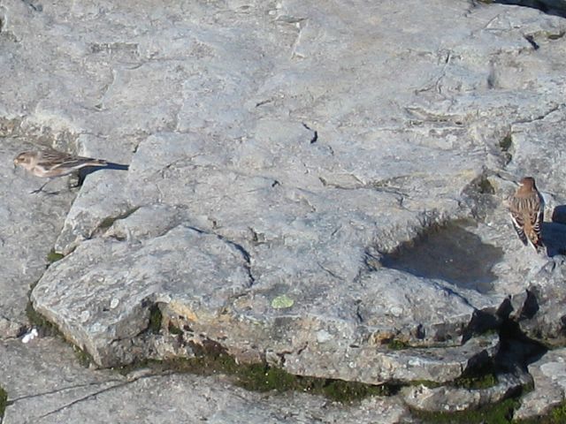 SnowBuntings.jpg |
 SnowBunting.jpg |
| The north and west sides of the summit plateau emerging from the clouds. | A rotor cloud on the lee side of the mountain to the Northeast, Great Glen below in the background. | Looking East towards a cloud capped Aonach Mor. | Looking west again as the cloud clears some more revealing some sheer drops and a distant Loch Eil. | There was life at the summit. Presumably this group of 5 or 6 Snow Buntings were feeding off scraps left by the hill walkers. | |
 MeAtBenNevisSummit.jpg |
 ViewEast2.jpg |
 ViewNorth1.jpg |
 Cliff2.jpg |
 Summit5.jpg |
 Cliff3.jpg |
| Me at the summit of Ben Nevis. Never mind my map case blowing around in the wind... Great Glen and Loch Lochy in the background 4000 feet below. The rotor cloud is still in the same place too. | More pictures taken from near the summit plinth, illustrating the steep 3000+ foot cliff to the north. | Then I went back to where Cliff1.jpg was taken, for another view of the summit and that cliff without the cloud. | |||
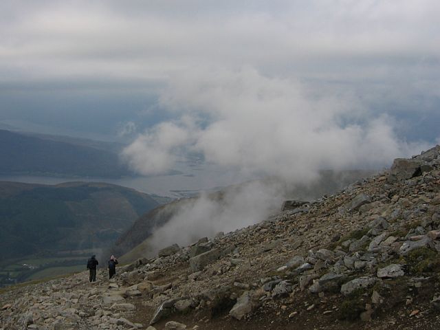
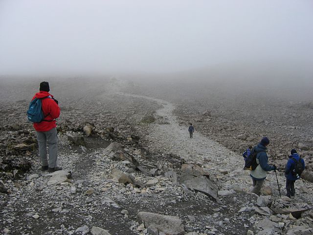 UpperTrail4.jpg |
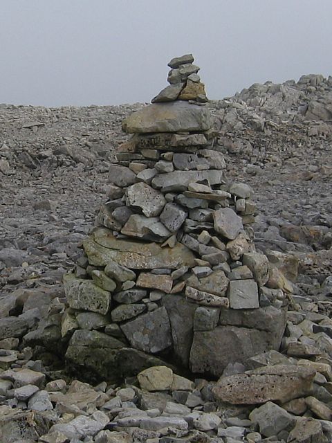 StoneMound.jpg |
 ApproachingCloudbase.jpg |
 FortWilliam1.jpg |
 FortWilliam2.jpg |
 GlenNevis4.jpg |
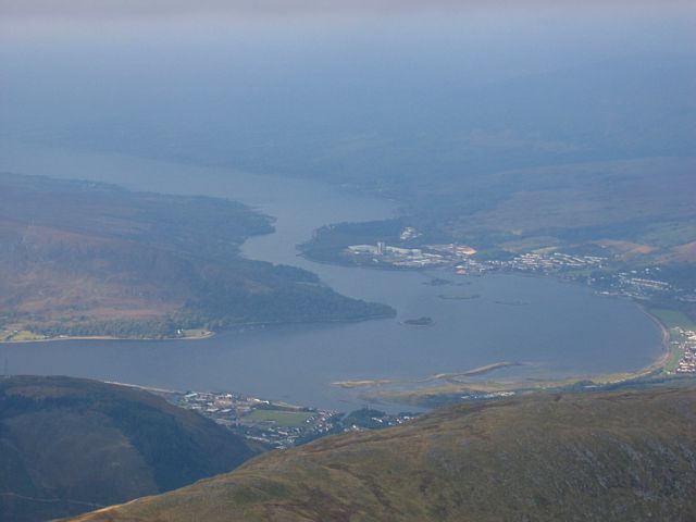
| The cloud came in again so I decided to descend. I had plenty of company. | One of many stone mounds marking the path. | Almost down to cloudbase, Fort William starts to appear. | My best shots of Fort William and the surrounding area. | Looking down at Glen Nevis again from about 3000 feet. | |
 MeOnWayDown.jpg |
 LowCloud1.jpg |
 Crepuscular.jpg |
 LowCloud2.jpg |
 LowCloud3.jpg |
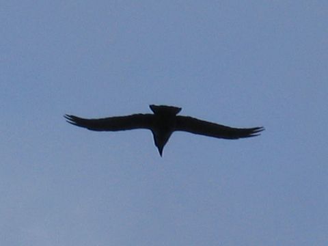
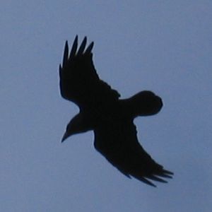 Raven1.jpg |
 Raven2.jpg |
| Me on the way down. At about 3000 feet. With Lochan Meall and the beginning of the Great Glen below. | As I descended below 3000 feet cloud amounts increased, low cloud started to form below me and the sun shining through the remaining holes produced nice effects. | Two shots of a Raven soaring past and making a characteristic deep honking noise. | ||||
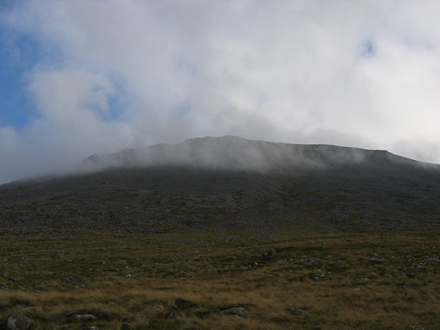 BenNevisCloud.jpg |
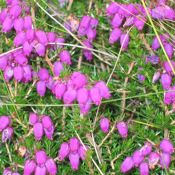 Heather.jpg |
 LowerTrail6.jpg |
Link to video on YouTube Name: Ben Nevis Cloud Video Length: 3m30s |
| Looking up towards the thickening clouds towards the summit as I approach the Lochan Meall plateau. | Back on the lower trail, I pause to admire the heather and the view from the top of the tree line. | A video containing a collection of clips of fast moving clouds taken at the summit of Ben Nevis. | |
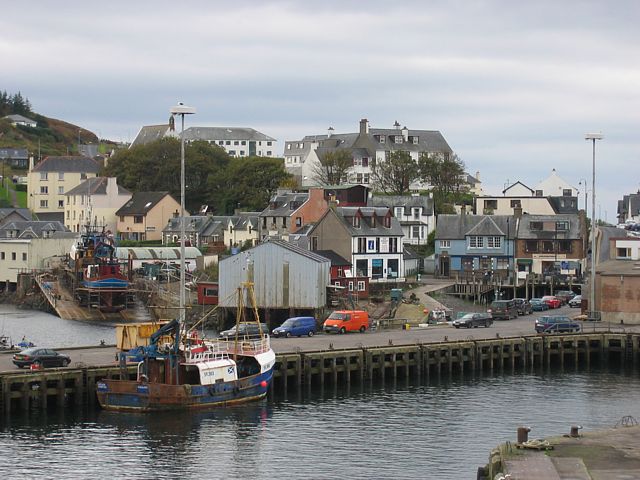
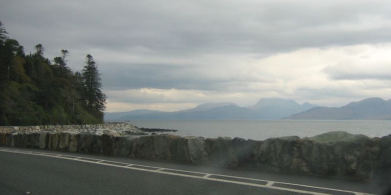
I headed from Fort William to Mallaig - the Road to the Isles. On the way I stopped at Glenfinnan viaduct, of Harry Potter fame, and at a beach called Silver Sands. Then I caught the ferry to Armadale on the Isle of Sky. Then I drove to Broadford before crossing the Skye Bridge to Kyle of Lockalsh. Here I stopped for lunch before continuing on the A87 back into the highlands. At a lookout point above a loch I found a piper playing his bagpipes in the pouring rain. Yep I am in Scotland alright! Then back round to Fort William via Spean Bridge.
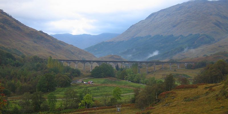 GlenfinnanViaduct.jpg |
 LochShiel.jpg |
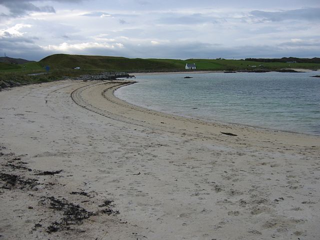 SilverSands1.jpg |
 SilverSands2.jpg |
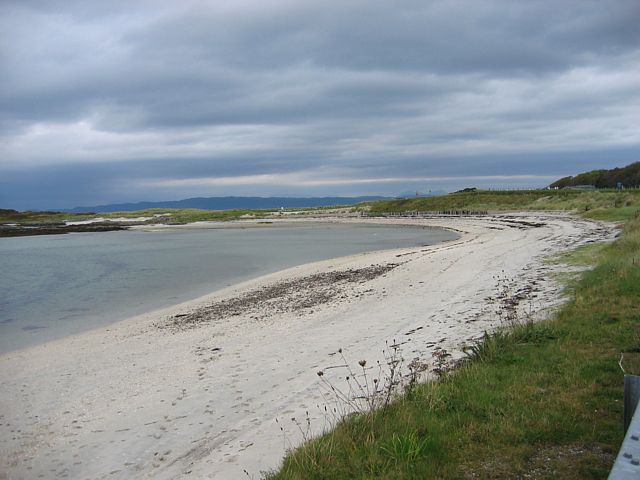 SilverSands3.jpg |
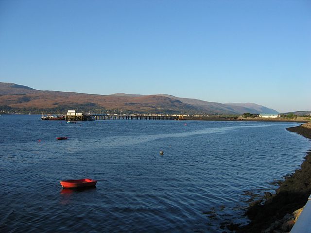
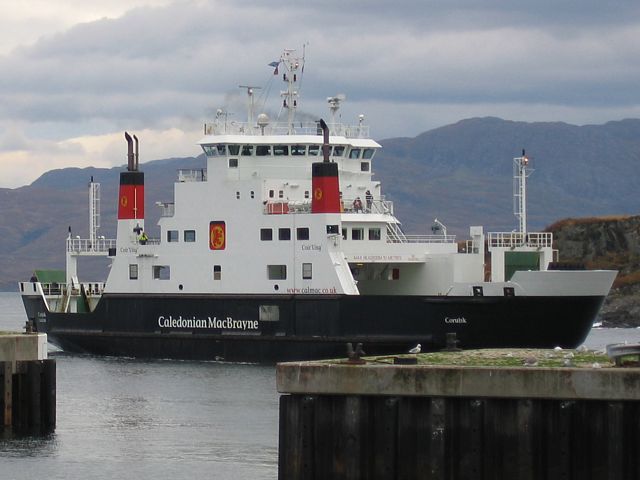 Ferry.jpg |
| Two shots taken from a lookout point near Glenfinnan. the viaduct was seen in the Harry Potter films. | Silver Sands, south of Mallaig. This beach had a tropical look to it. Shame the water was freezing cold. | The Mallaig - Armadale ferry arriving to take me to Skye. | |||
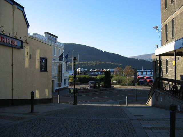
 Mallaig.jpg |
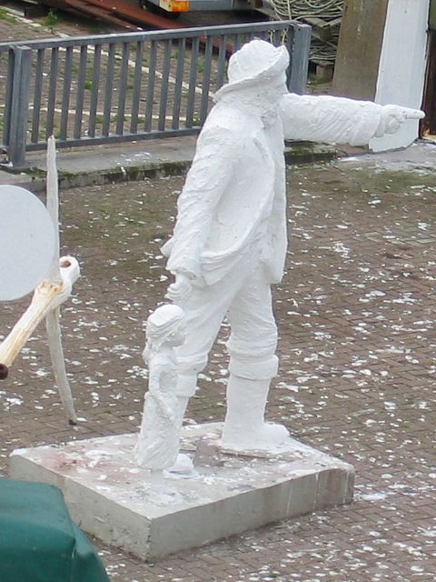 Statue.jpg |
 Skye.jpg |
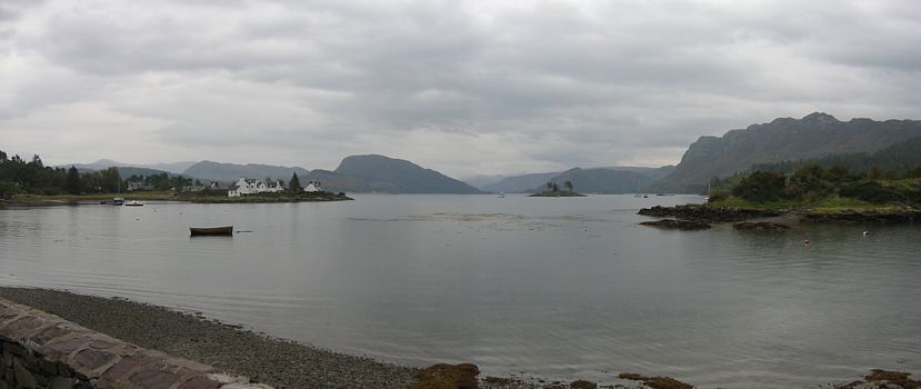
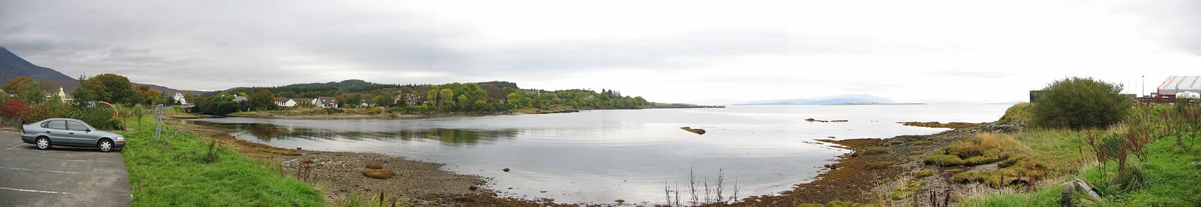 BroadfordBayPanorama.jpg |
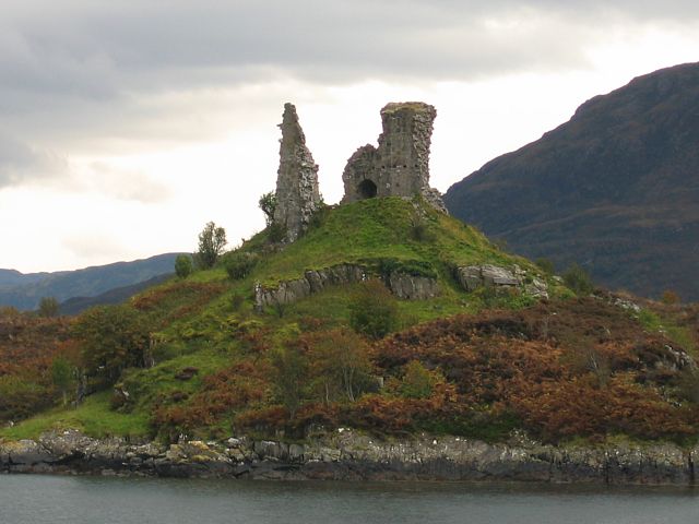 Ruins.jpg |
| Mallaig as seen from the ferry. | Statue pointing the way as the ferry left the harbour. | Now driving on Skye, looking across to the mainland. | Broadford Bay. | Ruins at Kyleakin. |
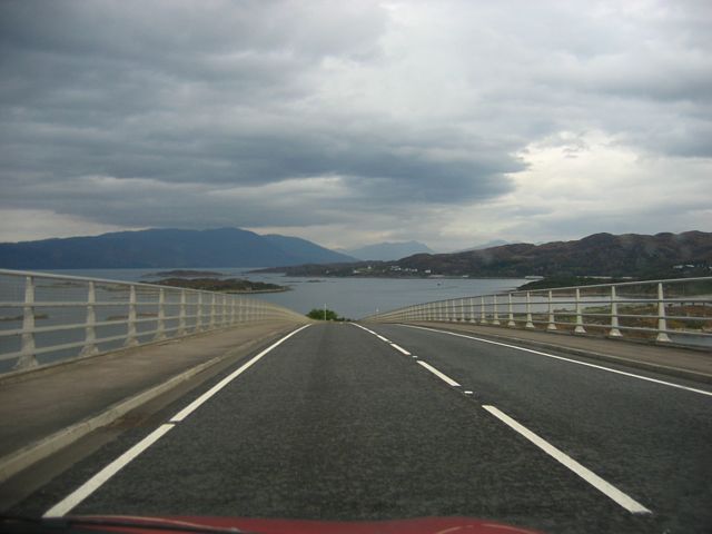 SkyeBridge1.jpg |
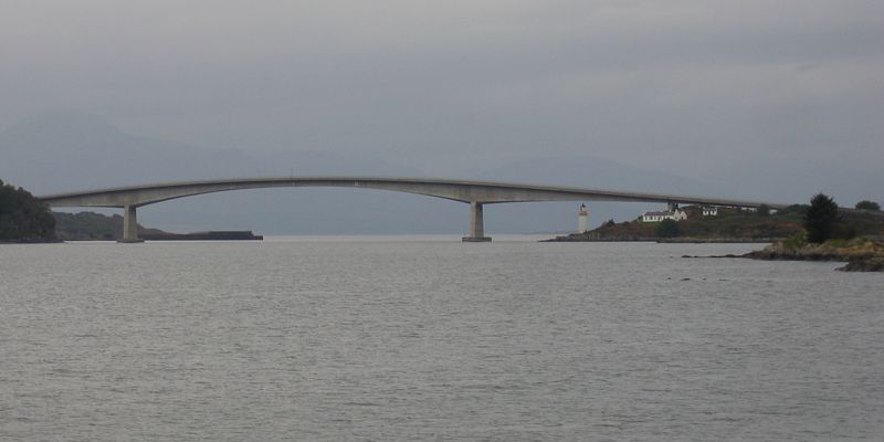 SkyeBridge2.jpg |
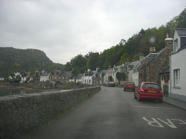 Plockton.jpg |
 PlocktonView.jpg |
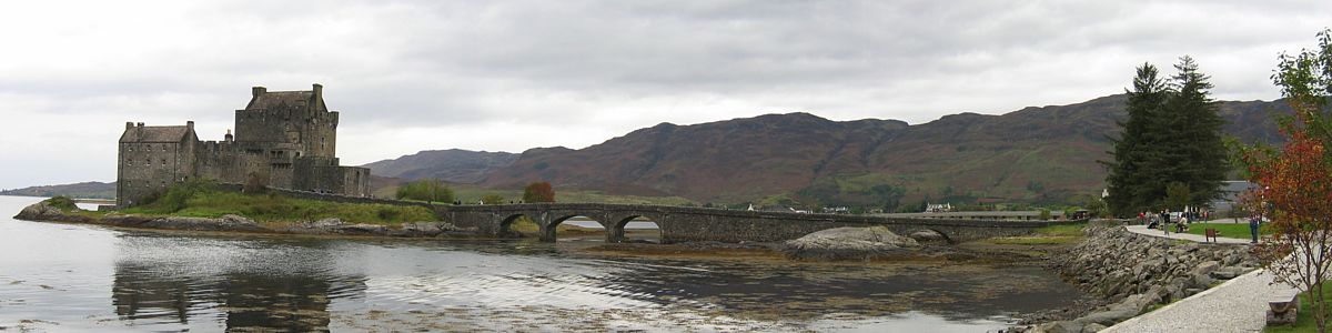 EileanDonanCastle.jpg |
| Crossing the Skye Bridge, then viewing it from Kyle of Lochalsh. | Plockton and the view across the water from there. | Panorama of Eilean Donan castle at the northen end of Loch Duich. | ||
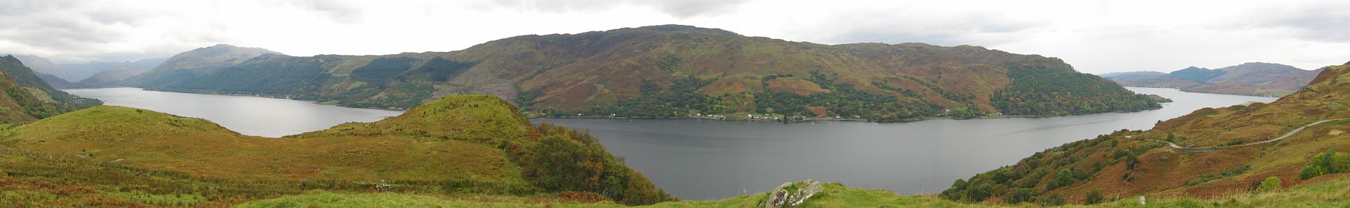 LochDuich.jpg |
 LochGarry.jpg |
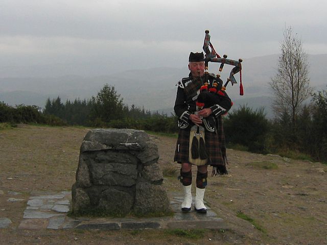 LochGarryPiper.jpg |
| Panorama of Loch Duich from a lookout point near Keppoch on the East side. | Even in the pouring rain Loch Garry looks beautiful from this lookout point. | A piper playing on the lookout point in the rain! That felt very Scottish! |
For more pictures please click here to go to Scotland 2007 Page 2.